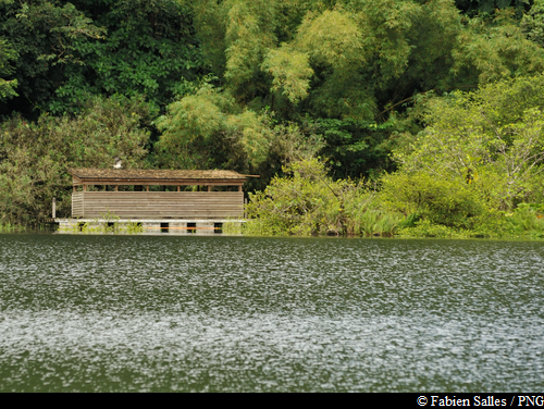
Grand Etang
There are 17 information points on the trail. Discover more information about them in the "Grand Etang Discovery Guide" (available for download on this page).
Renovation of the educational trail in 2026 !
19 points of interest
Palmier montagne - Emilie Savy / PNG  Flora
FloraSierran palm
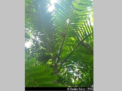
Prestaea montana is a member of the Arecaceae family. Despite its size, it is in fact a palm tree. Like ferns, it does not have a trunk but a stipe. It can flourish just as well in hygrophilous forests, where it can reach around ten metres, as at altitude, where it grows no taller than two metres.
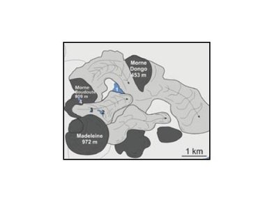
Illustration n°1 - BRGM  Pond
PondLe Grand Etang
The largest lagoon in the Basse-Terre mountains, the Carib Indians called it "the great water of the mountain".
More than 10,000 years ago, a natural depression was formed between the lava flows of the Madeleine and Morne Boudoute, pushing against Morne Dongo. With its waterproof clay bedrock, the natural basin quickly filled up with water, forming into the Grand Etang lagoon. With erosion over time, the Grand Etang gradually filled up with materials from the hillsides around it. Plant formations started to develop from the banks and shallows, eventually covering the entire lake. Unless suitable action is taken, such as pulling up and cutting down the plants and dredging the sediment, the Grand Etang looks set to disappear completely.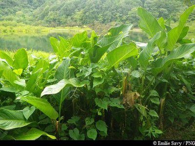
Canne d'eau - Emilie Savy / PNG  Flora
FloraInfo point 2 : "Kan'dlo"
A member of the Costaceae family, Costus speciosus, known locally as Kand'lo, is native to Southeast Asia. The plant is highly adapted to tropical regions. The plant's brick red ear is supported by a steam that measures between 1.5 and 2 metres. The flower buds turn into a vivid and colourful red ear, dotted with white flowers.
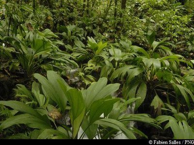
Ailes à mouches - Fabien Salles / PNG  Information board
Info point 9 : "Ailes à mouches"
The name of these herbaceous plants, which translates literally from the French as "fly wings", derives from the cleft nature of its leaves. The plant is particularly striking in the undergrowth of the rainforest.
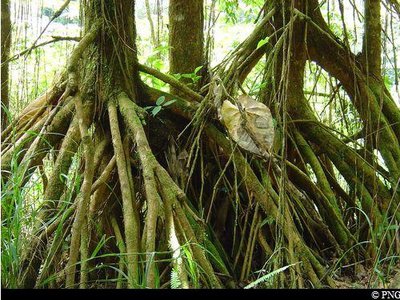
Palétuviers jaunes - PNG  Information board
Info point 10 : "The chewstick"
Symphonia globulifera, more commonly known as the chewstick, belongs to the Clusiaceae family. It is a tree that grows in thick, humid and swampy forests. Reaching up to 25-30 metres in height, it has stilt roots and a yellow latex trunk. Its flowers are formed of bright red petals and its fruits resemble nutmeg, are oval in shape and yellow when ripe. It wood was used as timber for houses and its latex resin was used to make boats.
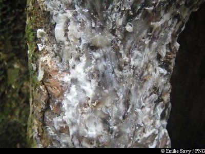
Gommier blanc - Emilie Savy / PNG  Information board
Info point 3: "The Gommier"
The Gommier (Daryodes excelsa) can grow up to 35m high. When they are damaged, its white trunk and roots exude a white resin with a pungent turpentine smell, which is traditionally used as incense or to start fires, because it burns slowly regardless of the surrounding humidity. It is reported that the tree has the ability to cast out spirits. It is strictly forbidden to take away any plant parts from the National Park. Its trunk was used by American Indians to make their canoes (kanawa), and is still used today by coastal people from many tropical countries, such as Dominique, to make fishing vessels. Its green seeds are popular with pigeons.
N.B. The numbered info points correspond to detailed and illustrated information, which can be found in the "Grand Etang Discovery Guide".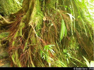
Bois rouge carapate - Emilie Savy / PNG  Flora
Flora"Bwa rouj carapate"
A member of the Euphorbiacieae family, Amanoa caribeae is endemic to the Lesser Antilles. It is a large tree with a trunk that rests straight on its buttresses, depending on the terrain. The most distinctive feature of this species is its reddish bark and roots at the foot of the trunk. Its leaves vary in shape: sometimes they are whole, sometimes pointed. Its flowers form small clusters, while its very hard wood was used as timber or in carpentry.
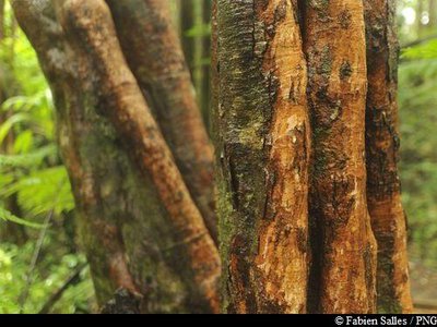
Bois cotelette noir (écorce) - Fabien Salles / PNG  Flora
FloraTapura latifolia
A member of the Melastomaceae family, Tapura latifolia is a small tree with a fluted trunk that seldom grows beyond 20 metres. Its leaves feature five main veins that run perpendicular to its many secondary veins.
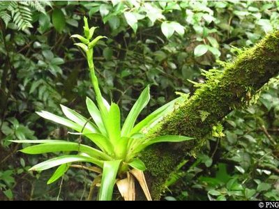
Plante épiphyte - PNG  Information board
Info point 4: "Epiphytes"
Epiphytes are plants that grown on top of other plants and are strikingly abundant in the thick rainforests of Guadeloupe. Attaching themselves to host trunks, branches and leaves, they form some truly startling hanging gardens. While some may grow close to the ground, they tend to grown high up in their search for light and because of the high humidity levels found there, which often exceed 80%.
N.B. The numbered info points correspond to detailed and illustrated information, which can be found in the "Grand Etang Discovery Guide".
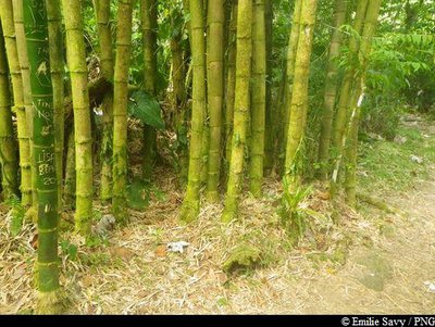
touffe de bambou - Emilie Savy / PNG  Information board
Info point 5: "Bamboo"
Bamboo (Bambousa vulgaris) was introduced by Europeans in the 17th, or most probably the 18th century. In Guadeloupe it has become an invasive species.
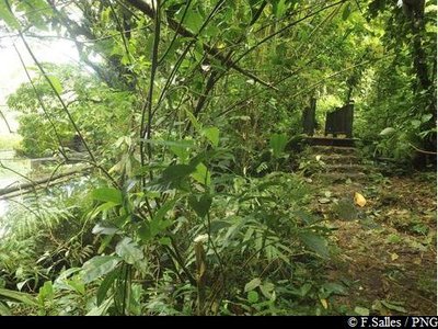
la passerelle - PNG  Pond
PondThe outlet
The Grand Etang lagoon forms the Bananier river through this outlet. At the high water level, the Grand Etang is level with the small dam, which can be seen from the footbridge. Lower down, the water seeps into cracks in the soil and carries on, feeding into the river. Depending on rainfall patterns, the water levels of the Grand Etang can fluctuate by 4 metres.
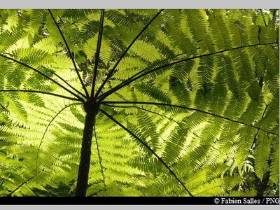
Fougère arborescente - Fabien Salles / PNG  Flora
FloraTree ferns
Tree ferns (Cyathea sp.), members of the Cyatheaceae family, include six species, the biggest of which (C. Arborea) can grow taller than 18 metres. Contrary to what the name suggests, tree ferns are not actually trees. The young leaves have the distinctive shape of a cross, while the black stipe is covered with petiole remnants. The fibrous material at the base of the stipe can be used to make sculptures and containers.
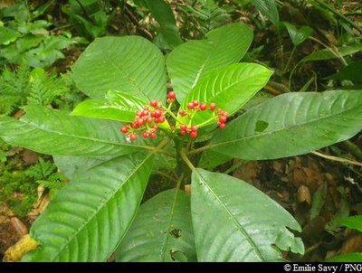
Café-Bois - Emilie Savy / PNG  Flora
FloraPsychotria uliginosa
A member of the Rubiaceae family, Psychotria uliginosa is rather rare in Guadeloupe, but is found at the Grand Etang and on the Monts Caraibes.
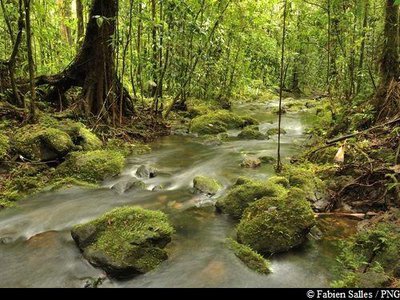
ravine traversant la trace - Fabien Salles / PNG  Information board
Info Point 12: "The gullies"
In contrast to the dark undergrowth of the thick forest, this enchanting place, lit up by effects of the light and the gentle lapping sound of the water, is an oasis of peace.
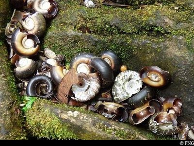
coquilles d’escargots mangées par une grive trembleuse - PNG  Information board
Info Point 13 : "The brown trembler's hideaway"
Every now again, near the path by the edge of the Grand Etang, you can see small clusters of snail shells amid the surface of the rocks. These are nothing other than the leftovers of the dinner of the brown trembler (Cinclocerthia ruficauda), which likes to feed on the snails that reside in the muddy and exposed areas of the Grand Etang.
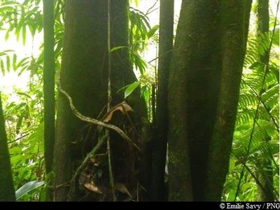
Corossolier montagne - Emilie Savy / PNG  Flora
FloraGuatteria caribeae
Guatteria caribeae is a very straight tree, often with multiple trunks, in the Annonaceae family. It has dark bark and hanging branches and produces dark and plump berries. Its bark was used to make ropes and its wood was used to make masts for boats. It is still used today in Guadeloupe to make traditional sailing dinghies.
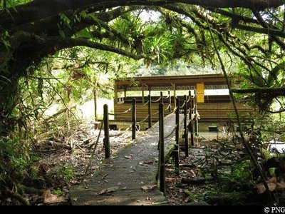
Observatoire ornithologique - PNG  Information board
Info point 15 : "The observatory"
This floating wooden structure makes for a great close-up on the life of the Grand Etang. Its unique location allows for ideal insights into the plant life and fauna of the lake. Information panels about the lake's birdlife are displayed above the viewing points. The ideal time for bird watching is after sunrise or before sunset. Don't forget to bring your binoculars.
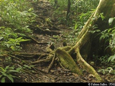
Au royaume des racines ... - F. Salles / PNG  Information board
Info point 16: "A fragile soil"
Plant roots in the soil are easy to spot throughout the trail. They are evidence of a young and shallow soil, which was only set down very recently.
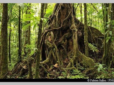
Acomat Boucan - F. Salles / PNG  Information board
Info point 17: "The tree of a thousand buttresses"
The Acomat boucan (Sloanea caribaea) belongs to the Elaeocarpaceae family. It is an extremely large tree that can grow up to 40 metres tall. It is the most spectacular tree in the Sloanea genus, with an exposed trunk and magnificent buttresses. Its bark is reddish-brown and tends to flake off in thin strips when the tree ages. Formerly, visitors to the forest would use its enormous buttresses to shelter their fires and to smoke meat. It has since been established that lighting fires among the roots is not conducive to the well-being of trees.
Description
Hiking trail colour: yellow
Read the information boards at the Etangs parking area.
Take the concrete road to Grand Etang. Enjoy the views and then take a left onto the small wooden lock bridge to start the circular trail. The trail cuts through a few small gullies. Keep going on the trail along the Grand Etang. Stop off at the observatory, where you will find some information boards about the lagoon's birdlife. Leave the observatory and take the path on the right, which crosses through an area of chewstick trees. When you come to the intersection, keep going straight, walking over the wooden decking. At the next intersection, turn left to return to the car park on the concrete road.
N.B. The numbered information points correspond to detailed and illustrated information, which can be found in the "Grand Etang Discovery Guide".
- Departure : Etangs parking area, Capesterre-Belle-Eau
- Arrival : Etangs parking area, Capesterre-Belle-Eau
- Towns crossed : Capesterre-Belle-Eau
Altimetric profile
Recommandations
As Guadeloupe is prone to natural risks, extra care should be taken in this natural environment. For the benefit of all hikers, responsible behaviour is very important.
Warning : the parking area is unsupervised.
Information desks
Reception area of Les Chutes du Carbet
terminus de la RD4 , route de l'Habituée, 97130 Capesterre-Belle-Eau
Opening hours : daily from 7.00 am to 5.00 pm.
Services : reception centre, shop, toilets, parking, picnic area.
In exchange for the services provided on the site, a financial contribution is requested to visitors (prices 06/2025 to 05/2028) :
- Adults : 6,00 € / pers.
- Children (- 12 years) : 4,00 € / pers.
- Families (5 pers. ; 1 or 2 adults + 1 or 4 children) : 14,50 €
- Groups adults (from 8 pers.) : 4,50 € / pers.
- Groups children (from 8 pers.) : 2,50€ / pers.
- One-year access card : 16,50 € / pers.
The promontory of the reception area is accessible to people with reduced mobility.
GPS location : Lat: 16,04198° N - Lng: 61,63822° W.
Headquarters of the National Park of Guadeloupe
Montéran, 97120 Saint-Claude
The reception and shop are open to the public :
- Monday, Tuesday and Thursday : 8 am to 12.30 pm and 2 pm to 5 pm.
- Wednesday : from 8 am to 1 pm.
- Friday : 8 am to 12.30 pm.
Services : reception, shop, toilets, free parking. Building accessible to people with reduced mobility.
Localisation GPS : Lat: 16,01634 N - Lng: 61,70753 W.
Access and parking
GPS coordinates of the start point : Lat : 16,02922 N - Long : 61,62748 W.
After Saint-Sauveur on Route RN1 (between Bananier and the village of Capesterre-Belle-Eau), head towards Les Chutes du Carbet. Continue on Route RD4. The road is steep. The Etangs parking area is shown at an intersection on the left.
Parking :
More information
Source
Report a problem or an error
If you have found an error on this page or if you have noticed any problems during your hike, please report them to us here:


