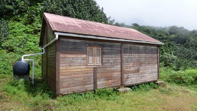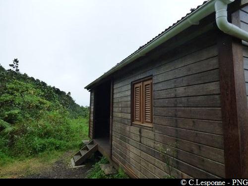
Access to La Citerne refuge
10 points of interest
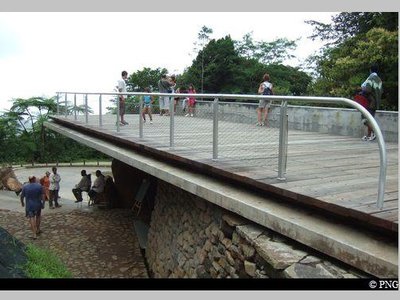
Promontoire de l'aire d'accueil du Carbet - PNG  Viewpoint
Promontory, extensive views
Accessible to persons with reduced mobility, on a clear day this promontory offers a panorama of la Grande-Terre (Petit Cul-se-sac marin), Marie-Galante and la Désirade.
The information boards explain the geological formation of the waterfalls.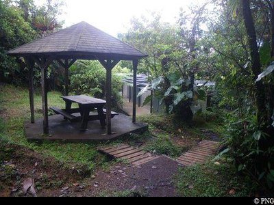
aire de pique-nique des Chutes du Carbet - PNG  Area of relaxation
Picnic area
A small path leads to the toilets and a special picnic area.
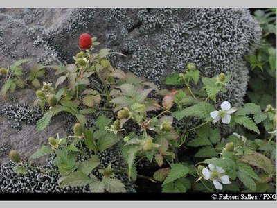
"Framboisier montagne" - Fabien Salles / PNG  Flora
FloraRoseleaf bramble
A member of the Rosaceae family, Rubus rosifolius is a hygrophilous species (i.e. one that needs moisture) which thrives in moderate shade: its white flowers and red fruits need the sun to grow. It is found up to 1,500 metres above sea level, where it colonises the banks of forest paths, invades the undergrowth of tropical forest and forms dense thickets. Its fruits are especially popular among birds.
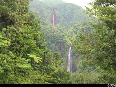
Vue sur les deux Chutes - PNG  Viewpoint
Views of both the Chute du Carbet waterfalls
Views of the first and second Chutes du Carbet waterfalls and information panels.
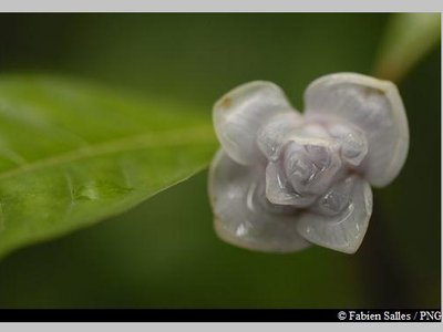
Graine bleue montagne - Fabien Salles / PNG  Flora
FloraPsychotria aubletiane
Psychotria aubletiane, also known as Ipeka bata, belongs to the Rubiacieae family. It is a wetland shrub with upright branches. It features elliptical leaves, white axillary flowers and fruits in small drupes that turn bright blue.
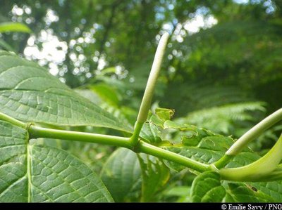
"Queue de rat" - Emilie Savy / PNG  Flora
Flora"Rat's tail"
This name refers to a number of species in the Piperaceae family.
As shrubs or small evergreen trees (ranging from 2-7 metres tall) with black, wart-like bark, rat's tails are a favourite among bats.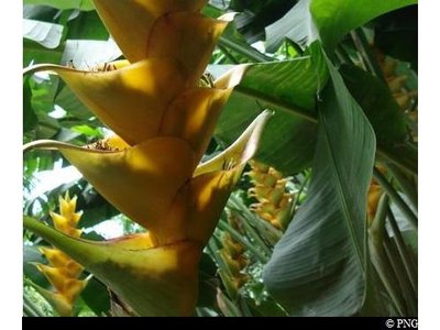
balisier - PNG  Flora
FloraBalisiers
A member of the Musaceae family, Heliconia caribaea is a large grass that is typical of the Lesser Antilles tropical rainforest. A member of the same family as the banana trees, the plant can grow up to 5 m high. It features an inflorescence that resembles a red ear or red ear with yellow trim, or sometimes completely yellow. Its flowers are visible all year round, most notably between April and June.
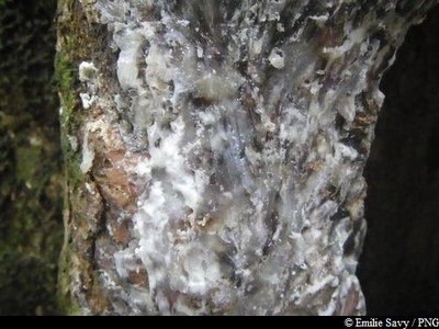
sève Gommier Blanc - PNG  Flora
FloraCandlewood
The candlewood is a majestic tree in our forests. It can grow to a height of 30m. It was once used by the Kalinagos (native Americans) to make boats known as "kanawa". The white sap is used in magical-religious rituals today and is also popular during the carnival with the "Groupes à Peau" ("Skin Groups") known as "MAS".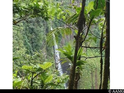
2ème Chute du Carbet - AAMG  Viewpoint
View over the 2nd waterfall
Very fine view over the 2nd Carbet Fall.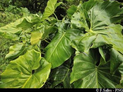
Siguine blanche - PNG  Flora
Flora"Elephant's Ear"
More often called Taro, it is both saxicolous (living on rocks) and epiphytic (using other plants for support).
Description
At the Chutes du Carbet car park, follow the hiking trail to the first intersection (point 1) about 150m along the trail.
Then take the path to the left and begin the climb, passing through the 2 small gullies. Enjoy the view from the Carbet Falls without going too near the edge.
Continue up to the intersection (point 2) and then turn left, pass the river if it is not flooded.
After about 100m, you will arrive at the refuge.
It is possible to spend the night here.
The winding road leading to "L'Echelle" is still closed (due to a rock slide in April 2020).
- Departure : Carbet Falls visitors' area
- Arrival : La Citerne refuge
- Towns crossed : Capesterre-Belle-Eau
Altimetric profile
Recommandations
---
Don't set off after 3 pm. Night falls very quickly at some times of the year.
It is recommended to be physically fit.
Ask a mountain guide to go with you.
NB: unsupervised car park.
Information desks
Reception area of Les Chutes du Carbet
terminus de la RD4 , route de l'Habituée, 97130 Capesterre-Belle-Eau
Opening hours :
- In low season (May 1st to June 30th, September 1st to October 31th) : daily from 7.00 am to 1.00 pm.
- In high season (November 1st to April 30th, July 1st to August 31th : daily from 7.00 am to 4.30 pm.
Services : reception centre, shop, toilets, parking, picnic area. The promontory of the reception area is accessible to people with reduced mobility.
In exchange for the services provided on the site, a financial contribution is requested to visitors (prices 06/2023 to 05/2024) :
- Adults : 5.45 € / pers.
- Children (- 12 years) : 3.30 € / pers.
- Families (2 adults + 2 children): 7.60 €
- Groups adults (from 8 pers.) : 3.80 € / pers.
- Groups children (from 8 pers.) : 1,65€ / pers.
- One-year access card : 8.75 € / pers.
GPS location : Lat: 16,04198 N - Lng: 61,63822 W.
Access and parking
In Capesterre-Belle-Eau, on the RN1 road, head for Saint-Sauveur. Then take the RD4 road towards L'Habituée. Follow this road to the end, the Carbet Falls visitors' area.
Parking :
More information
Source
Report a problem or an error
If you have found an error on this page or if you have noticed any problems during your hike, please report them to us here:


