From Anse Laborde to Porte d'Enfer (2nd stage)
Anse-Bertrand North Grande-Terre circular trail
 Coastal trail
From Anse Laborde to Porte d'Enfer (2nd stage)
Easy
5h
12,8km
+273m
-279m
Cross
PR (short hike network)
MBT
Embed this item to access it offline
Take the Loop's hiking trails to explore the riches of North Grande-Terre !
12 points of interest
PNG  Geology
Trou de Man Louis
The only accessible beach with Anse Laborde on this side, barely visible from the cliffs (on the leeward side); the place for cliff fishing, including for 'bougo' (shellfish).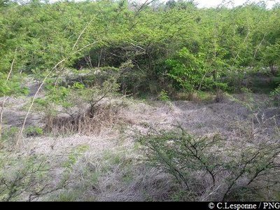
"Yaya", terrains en friche - PNG  Cultural and architectural heritage
'Yaya'
Yaya is a mystical space to the north of the village, where you may encounter spirits and other beings (mentioned in the story of Man Koko).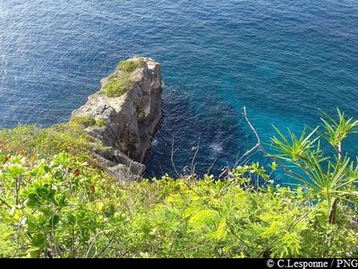
Pointe à Claude, territoire Caraïbe - PNG  History
Caribbean site
The site of the village of the last Caribbeans in Guadeloupe, until the beginning of the twentieth century, in the heart of what was then known as the Caribbean Reserve.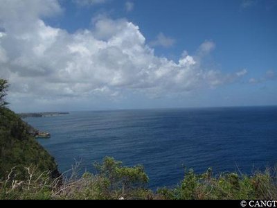
Pointe Montagnier - CANGT  Viewpoint
Pointe Montagnier
A rare viewpoint of this part of the cliffs, open to the Caribbean Sea and the Canal de la Guadeloupe.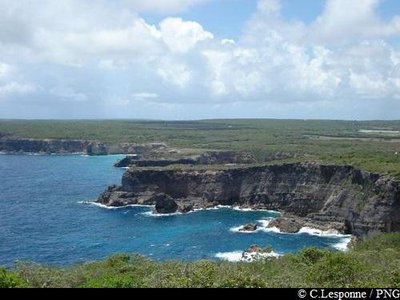
vue vers les falaises (sud) - PNG ViewpointPointe de la Grande Vigie
Pointe de la Grande Vigie, with its parking area and its double pathway to explore the site, going towards the point.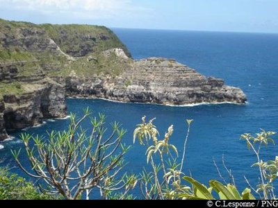
vue sur "La Tortue" depuis la Grande Vigie - PNG GeologyPetite Tortue
Pointe de la Petite Tortue, a cliff overhang shaped like the head of a turtle.
Savane Desrosières - CANGT  Pond
PondSavane Desrosières
Savane Desrosières : vast space of the Caribbean Reserve, with its pools and grazing land, open to the never-ending movement of the Atlantic waves.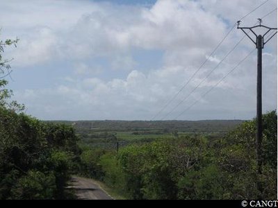
Couloir de Budan / St-Jacques - CANGT  Agricultural landscape
Couloir de Budan - St Jacques
The end of the Anse-Bertrand plateau, where we see a row of the more northerly sugar works of eighteenth century Guadeloupe, including those of Budan and St Jacques.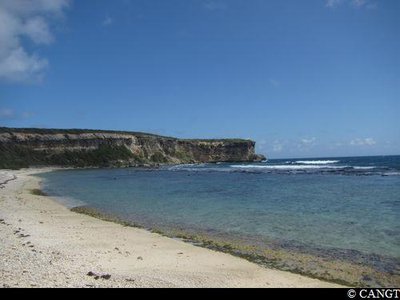
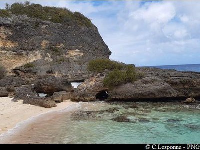
l'Anse Pistolet - CANGT GeologyAnse Pistolet
The Pointe de la Grande Vigie's only maritime access and the natural entrance to the south-west plain from the eighteenth century onwards, L'Anse Pistolet nestles between the cliffs occupied by the Amerindians millennia ago.
(The Anse is visible 400m to the north of the main road).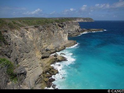
l'Anse à Tortues - CANGT ViewpointAnse à Tortues
A spectacular viewpoint nearer the edge of the cliffs, at the feet of which lies a cove of white sand, home to turtles when they come to lay their eggs.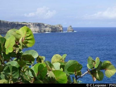
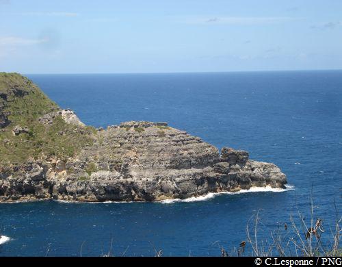
Le Piton (vue du sud-est) - PNG GeologyPointe du Piton
Pointe du Piton: witness to the tectonic movements at the start of the Grande-Terre region, and coastal erosion.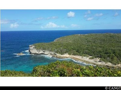
vue sur la Porte D'Enfer - CANGT GeologyOverlooking the Porte d'Enfer
At the start of Cadou: go west from the ridge, overlooking the lagoon of Porte d'Enfer, an open book of the geological history of Guadeloupe.
Description
Hiking trail colour : yellow.
---
Starting from Anse Laborde beach, this second stage follows the Trace des Pêcheurs to the north, to the Pointe de la Grande Vigie.
From there, go back down following the RD122, then at the crossroads head for the Porte d'Enfer, your destination on this second stage.
--
Source of information: Discours interprétatif de la Boucle du nord Grande-Terre - CANGT / AVPMC J.Barfleur, 2016.
--
For more information on the Grande-Terre Northern Loop, go to:
http://www.randoguadeloupe.gp/informations/partenariats/
- Departure : Anse-Bertrand, Anse Laborde beach.
- Arrival : Anse-Bertrand, Porte d'Enfer.
- Towns crossed : Anse-Bertrand
Altimetric profile
Recommandations
Be careful when walking along or crossing the road (beware of traffic).
Do not go near the edge of the cliffs: risk of collapse.
NB: Be careful: there is a lot of sargasse (brown algae) in the lagoon at Porte d'Enfer.
As Guadeloupe is prone to natural risks, extra care should be taken in this natural environment. For the benefit of all hikers, responsible behaviour is very important.
Please note: the parking and swimming areas are not supervised.
Information desks

2 rue Gambetta, 97117 Port-Louis
Access and parking
Starting point : Lat : 16,483417 N - Long : 61,501789 W.
---
As you come out of Anse-Bertrand heading north: take the RD122. Pass near the military camps then turn left, heading for Anse Laborde beach.
---
As you come out of Anse-Bertrand heading north: take the RD122. Pass near the military camps then turn left, heading for Anse Laborde beach.
Parking :
Anse-Bertrand, beach of Anse Laborde.
Accessibility
At Porte d'Enfer there is a picnic carbet and wooden access boards suitable for persons with reduced mobility ; braille information panels.
- Emergency number :
- 114
More information
Source
Rando Guadeloupehttps://www.randoguadeloupe.gp/
Report a problem or an error
If you have found an error on this page or if you have noticed any problems during your hike, please report them to us here: