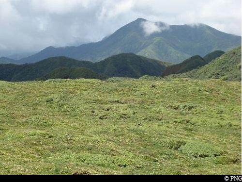
La Soufrière from Carmichaël
The Carmichaël is one of the most spectacular trails on offer. Its name alludes to an old family from Guadeloupe, possibly of English origin." Gérard Werter, "Coureur des Bois".
22 points of interest
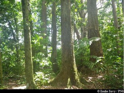
plantation d'Eucalyptus - Emilie Savy / PNG  Flora
FloraEucalyptus
Members of the Myrtaceae family, Eucalyptus trees were originally imported from Australia. They prosper in moist and acidic soil. The bark comes off in patches and the tree exudes a resinous gum when damaged.
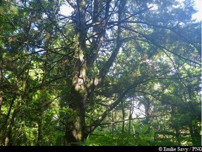
Cyprès - Emilie Savy / PNG  Flora
FloraCyprus trees
The cypress tree belongs to the Cupressaceae family. With an easily recognisable smell, this tree was introduced to Guadeloupe as an ornamental species.
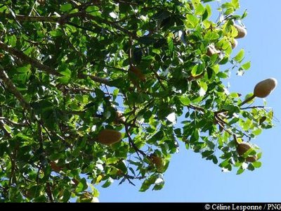
 Flora
FloraWest Indian Mahogany
The West Indian Mahogany (Swietennia macrophylla) belongs to the Meliaceae family. It is a perennial tree with a large, upright, cylindrical bole and small, yellow-green flowers. This species - highly prized by woodworkers on account of its hardness and colouration - was introduced for the purposes of producing timber, leading to the tree being overexploited in its area of origin. It is listed in Appendix II of the threatened species covered by the Washington Convention.
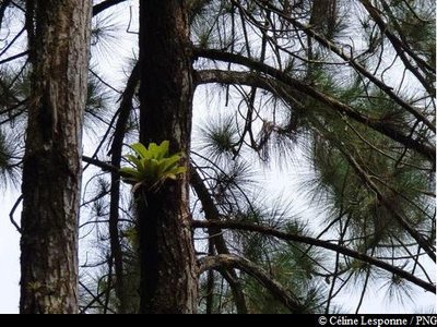
PNG  Flora
FloraCaribbean pine
The Caribbean pine (Pinus caribeae) is a member of the Pinaceae family. Now considered an invasive species in Guadeloupe, this tree was introduced so that its wood could be used as timber. It has noticeably cracked, reddish-brown bark, while the inner bark is highly resinous. It has a slender top which is shaped like a rounded pyramid.
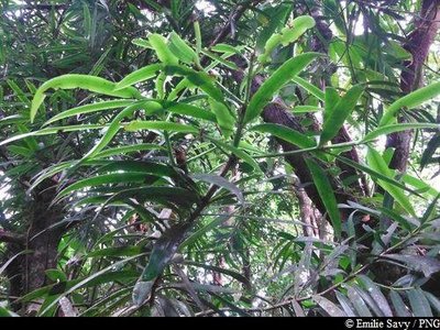
E.Savy - PNG  Flora
FloraThe Yucca Plum Pine
A member of the Podocarpaceae family, the Yucca Plum Pine (Podocarpus coriaceus) is also known locally as the "Wood rose". Closely related to conifers, it is an average-sized tree, with leathery leaves that are dark green on top and similar to an oleander's. Its brown-coloured seeds in their floral buds are particularly eye-catching. It has a thin layer of bark. This species flowers mainly in December/January, with inconspicuous flowers.
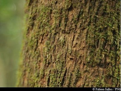
Bois bandé (détail écorce) - Fabien Salles / PNG  Flora
Flora"Bwa bandé"
Richeria grandis belongs to the Phyllanthaceae family. It is a large variety, distinctive for its tough leaves and reddish-brown bark that so often falls victim to rogue extraction. Also known as bwa bandé in Créole, it is renowned for its aphrodisiac qualities. Its wood is used as timber or in carpentry. It has very distinctive, green, grape-like fruits which form small pods and form copiously on its branches.
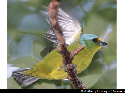
Organiste Louis D'Or - Anthony Levesque / Amazona  Fauna
FaunaAntillean euphonia
The Antillean euphonia (Euphonia musica) is also known as Douvan nwèl in Creole. The bird is distinctive for its bright blue crown and neck, while its cheeks are a darker shade of blue/green. It has a bright yellow breast and chin. Its back is olive and green, while its belly is yellow/green. This sedentary nesting bird is not very common in Guadeloupe, but it is found in the rainforest at medium altitude. It is on the IUCN Red List and is one of the species on to make the list of nesting birds in Guadeloupe.
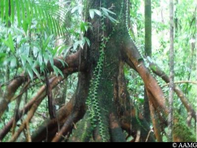
Patétuvier jaune - AAMG  Flora
FloraCandlewood
Symphonia globulifera, also commonly known as the chewstick tree, belongs to the Clusiaceae family. The tree grows in thick, humid and swampy forests. Reaching up to 25-30 metres in height, it has stilt roots and a yellow latex trunk. Its flowers are formed of bright red petals, while its fruits resemble nutmeg, are oval in shape and yellow when ripe. It wood was one used as timber for houses and resin for boats.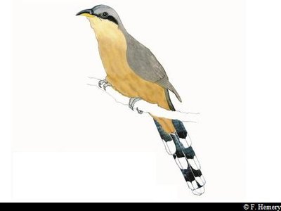
"Coucou manioc" - F. Hemery  Fauna
FaunaMangrove cuckoo
The Mangrove cuckoo (coccyzus minor) is also known as the Coucou Manioc in Creole. It is recognisable for its black patch over one eye, for its long, layered tail and for its beak, which curves downwards. It measures between 28-31 cm.
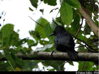
Pic de la Guadeloupe - Fabien Salles / PNG  Fauna
FaunaGuadeloupe woodpecker
The only endemic bird species to the country, the Guadeloupe woodpecker measures 26-28 cm. Its beak is long and slender and, in the male, is longer than the head, unlike in females. It is adorned with black plumage, has a blood-red throat and belly and blue/black back. It can be seen quite frequently on tree trunks, which it hammers into with its powerful beak (hence its Creole name of "Toto bwa"). It moves over short distances in rippling, gliding movements. The Guadeloupe woodpecker is included on the list of endangered species.
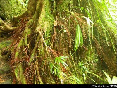
Bois rouge carapate - Emilie Savy / PNG  Flora
FloraAmanoa caribeae
Amanoa caribeae belongs to the Euphorbiaceae family. This species is endemic to the Lesser Antilles.
It is a large tree with a trunk that rests straight on its buttresses, depending on the terrain. The most distinctive features of this species are its reddish bark and roots at the foot of the trunk. Its leaves vary in shape: sometimes they are whole, sometimes pointed. Its flowers form small clusters. The hard wood of this tree was used as timber or in carpentry.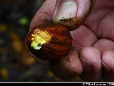
fruit du Palétuvier jaune - PNG  Flora
FloraSymphonia globulifera
Symphonia globulifera, also commonly known as the chewstick tree, belongs to the Clusiaceae family. The tree grows in thick, humid and swampy forests. Reaching up to 25-30 metres in height, it has stilt roots and a yellow latex trunk. Its flowers are formed of bright red petals, while its fruits resemble nutmeg, are oval in shape and yellow when ripe. It wood was one used as timber for houses and resin for boats.
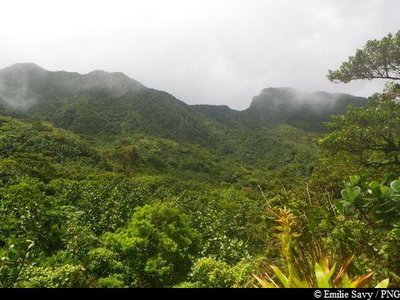
vue sur le Nez Cassé - Emilie Savy / PNG  Viewpoint
Le Nez Cassé
Views of le Nez Cassé, summit located to the west of la Soufrière.
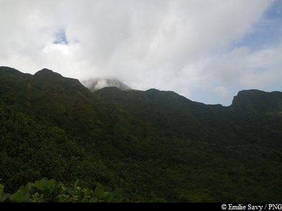
Le Camp Maréchal - Emilie Savy / PNG  Geology
Morne du Col
Heading south, views of la Grande Faille de la Soufrière and le Morne Amic. Le Camp Maréchal is located in a caldeira, formed during a volcanic eruption. Towards the northeast, overlooking la Montagne de la Capesterre.
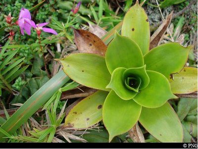
broméliacée (ananas) - PNG  Flora
FloraGuzmania plumieri
A member of the Bromeliacieae family, Guzmania plumieri is a tropical grass. An epiphytic (growing on tree branches) or terrestrial plant, there are 40 species of it. Its leaves are upright, rigid, thick and arranged in the form of a rosette and take in a lot of water, making them a very popular home for frogs. It features a yellow floral scarp in the middle.
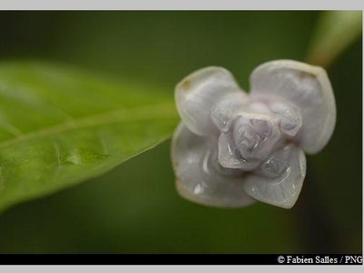
Graine bleue montagne - Fabien Salles / PNG  Flora
FloraPsychotria aubletiane
Psychotria aubletiane, known in Creole as "Ipeka bata", is a member of the Rubiaceae family. It is a wetland shrub with upright branches. It features elliptical leaves, white flowers and fruits in small drupes that become a bright blue.
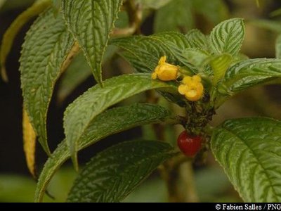
"Bois graine rouge" - Fabien Salles / PNG  Flora
FloraBesleria lutea
Besleria lutea is a virtually perennial shrub with a shiny yellow inflorescence. It has dark green, leathery leaves and red berries.
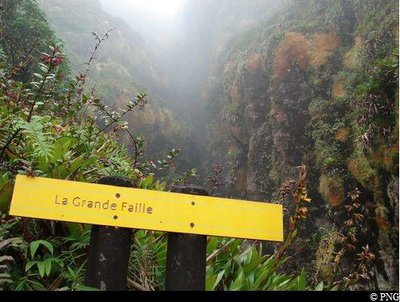
La Grande Faille - PNG  Geology
La Grande Faille
"La Grande Faille (The Great Fault) of the north, at around 100 metres deep and 3-4 metres wide, crosses La Soufrière from north to south [...]. In its northern section, it featured a chasm measuring 15 metres long, covered with a thick layer of sulphur crystals, which has been given the rather grand name of "Lac de Soufre" (Sulphur Lake)." Gérard Werter, "Coureur des Bois". On account of erosion caused by rainwater, sulphur powder has completely disappeared.
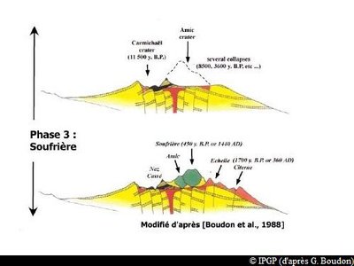
Formation de la Soufrière (phase 3) - IPGP (d'après G. Boudon)  Geology
How La Soufrière was formed
La Soufrière is part of a recently-formed volcanic complex, situated in the south of Basse-Terre. It consists of two formations: the composite volcano of la Grande Découverte, whose last activity resulted in the creation of La Soufrière, and the smaller volcanic complex of la Madeleine - located to the southeast of the former.
There were three primary phases behind the formation of La Découverte.
* 200,000-42,000 years ago : Grande Découverte phase.
On the south side of the Pitons de Bouillante and Sans Toucher: alternating lava flow stages and pyroclastic stages. These brought about the formation of the Grande Découverte caldera, of which only the northern wall remains visible today.
* 42,000-11,500 years ago : Carmichaël phase.
Formation of the Carmichaël massif, dominated by lava flows, within the Grande Découverte caldera. Two successive eruptions destroyed the uppermost part of the volcano.
* 8,500 years ago - present : Soufrière phase.
Eruptions took place largely within or on the rims of the Amic crater. Three magmatic eruptions followed, giving rise to the current form of La Soufrière and l'Echelle.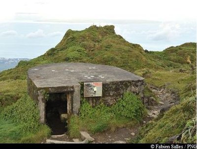
abri de la Soufrière - Fabien Salles / PNG  Mountain shelter
La Soufrière shelter
It was opened in 1935 by governor Bouge. Among the 1,000 people who climbed the volcano that day to attend the ceremony was Camille Thionville, the founder of the Mountaineering Club. He was 78 and this trip was to be his last hike of the volcano. At the time, it was common for hikers to spend the night in this small shelter.
Renovated in 1982, it is now open as a shelter in the event of bad weather.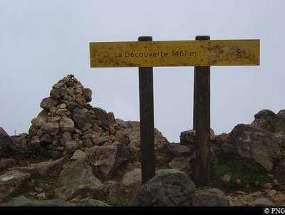
sommet de la Soufrière : "la Découverte" - PNG  Summit
Top of La Soufrière
Situated at 1,467 metres above sea level, La Découverte is the highest point in Guadeloupe and the Lesser Antilles. On a good day the views can be spectacular, but it is also extremely common for there to be gusts of 50 km/h! With bumps and stony crevices, the plateau at the summit of La Soufrière offers a lunar-like landscape in places. It was the French naturalist Felix Herminier who was responsible for the toponymy of the summit of La Soufrière.
"La Guenon" de La Porte d'Enfer - PNG  History
La Porte d'Enfer
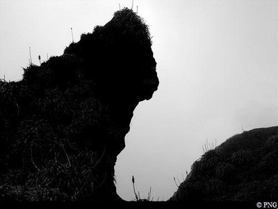
Here, at La Porte d'Enfer ("Hell's Gate"), bold and intrepid visitors to La Soufrière would complete their final ascent of the volcano. They stopped off half way through the Chemin des Dames and climbed the steep slope to reach it. It is guarded by La Guenon, a rock with a monkey-like face, which dominates one of the walls of this site. Not so far away from here, Le Piton Dolomieu (1,464m) is also visible. There are many names that allude to the infernal dimension of La Soufrière: la montagne à diables (devil mountain), le pont du diable (devil's bridge), la mare aux diables (devil pool), le diablotin (the little devil) and of course, la Porte d'Enfer itself.
Description
Hiking trail colour: yellow
Take the trail that climbs to the left of the information board. The trail begins with a steady climb among the tall trees of the rainforest. Cross the Madame François ravine. At the intersection turn right. Keep going straight, do not take the informative trail which starts again at the beginning. After walking for around one hour, go straight on at the intersection. At "Morne du Col", turn right towards "Carmichaël" and "Soufrière". That trail can often be muddy. Keep going straight on, leaving the intersection for le Col de l'Echelle on your left. Once you reach la Grande Faille, take a left to begin the final ascent towards the summit of La Soufrière.
Go around the top plateau of La Soufrière from the right, and then head back down towards La Grande Faille. Then turn right in the direction of "Trace Carmichaël" and "Matouba". Keep going on the same path that you used to come up to return to the car park at the start. You can also come back down La Soufrière via le Col de l'Echelle or by le Chemin des Dames, leaving your car in the Bains Jaunes parking area.
N.B. At the start of the forest house, the National Forestry Office offers a "Sylvascope" guide to understand the path. Featuring some interesting trivia about the environment, this audio guide allows you to discover the forest. Numbered information markers along the path correspond to relevant audio on the device. Return the guides to the Gourbeyre National Forestry Office Sylvathèque before heading to Matouba. For more information, contact the Forestry Office on 0590 81 37 57 or 0590 99 28 99. You can now download the Sylvascope app directly on Google Play and Apple.
- Departure : Matouba forest house, Saint-Claude
- Arrival : Matouba forest house, Saint-Claude
- Towns crossed : Saint-Claude and Capesterre-Belle-Eau
Altimetric profile
Recommandations
As Guadeloupe is prone to natural risks, extra care should be taken in this natural environment. For the benefit of all hikers, responsible behaviour is very important.
Beware of sulphurous gas emissions, which are highly toxic: do not cross the protective barriers. In the event of bad weather at the summit plateau of La Soufrière, such as rain or fog, follow the yellow stakes in the ground carefully.
Please note : the parking and swimming areas are not supervised.
Make sure you adhere to any rules issued by the Regional Health Agency concerning hot baths.
Information desks
RD11, route de la Soufrière, 97120 Saint-Claude
Headquarters of the National Park of Guadeloupe
Montéran, 97120 Saint-Claude
The reception and shop are open to the public :
- Monday, Tuesday and Thursday : 8 am to 12.30 pm and 2 pm to 5 pm.
- Wednesday : from 8 am to 1 pm.
- Friday : 8 am to 12.30 pm.
Services : reception, shop, toilets, free parking. Building accessible to people with reduced mobility.
Localisation GPS : Lat: 16,01634 N - Lng: 61,70753 W.
Access and parking
GPS coordinates of the start point : Lat : 16,04668 N - Long : 61,69177 W.
Go past the Post Office and then take a left onto Avenue du Maréchal Foch, passing the Tourist Office and City Hall. At the stop in front of the church, turn right onto Route RN3 which leads up towards Matouba. Go past three bridges and the Rivière Rouge picnic area. Then keep going until the top of the hill. A sign showing the informative trail of Matouba will direct you to the parking on the right-hand side of the road, just before the Maison Forestière (National Forestry Office).
Parking :
More information
Source
Report a problem or an error
If you have found an error on this page or if you have noticed any problems during your hike, please report them to us here:


