Visit to Ilet du Gosier
Its history is closely linked to human settlements since the native American period. A large number of remains bear witness to these different settlements, with the most remarkable ones linked to the lighthouse keepers.
3 points of interest

Phare du Gosier - AAMG  Cultural and architectural heritage
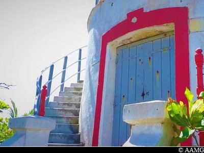
Lighthouse
This is the 3rd lighthouse. It is 21 metres high and dates from 1932. The first was built in 1852 and the second in 1882. The frequent storms that sweep across the archipelago destroyed the two previous lighthouses. The present lighthouse is made up of two parts, with the technical facilities in the bottom third. The lighthouse has been automatic since 1973. The last lighthouse keepers left after Hurricane Hugo in 1989.
AAMG  Viewpoint
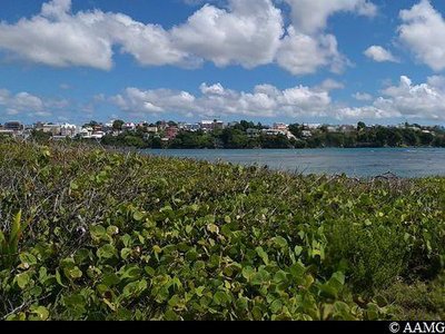
Pointe ilet panorama
A view over the Gosier coast in Sainte-Anne, with a series of bays: Dupuy, Criquet, Bambou, Vinaigri.
At this site you can also see the remains of the mooring cables from the wind turbine, the only source of energy at the time to power the lighthouse. The wind turbine was destroyed by Hurricane Hugo in 1989 and was replaced by solar panels.
AAMG  Area of relaxation
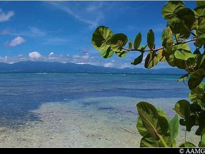
Beach and manchineel trees
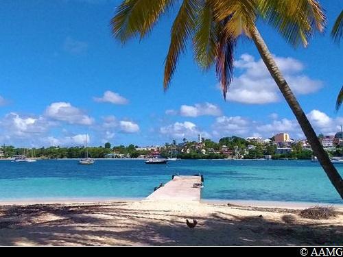
There are many great spots for a swim on the western side of the island.
Watch out for the manchineel trees! The sap in these trees makes all of the tree toxic (leaves, blossom, bark, fruit). The trees are marked with a blue cross. You are strongly advised not to take shelter under them in the rain.
Description
The trail begins behind the main beach on the island, in line with the jetty. You walk alongside the karbays and enter the vegetation. Go straight on along the path and head for the lighthouse and the panorama. Retrace your steps as far as the intersection, and then turn left.
You walk past the remains of a water tank. A few yards further on, follow the path to continue the circuit. Continue along the path all the way to the main beach.
Please note, a lot of small tracks might lead you off the trail.
- Departure : Ilet Gosier jetty
- Arrival : Ilet Gosier jetty
- Towns crossed : Le Gosier
Recommandations
You can take a round trip from the town to the island on a shuttle boat. The boats make the trip every 30 minutes and cost €5 per person (free for children under 4).
Information desks
Office du tourisme du Gosier
rue Félix Eboué, 97190 Le Gosier
Transport
You can also take a "Karulis" bus to the jetty.
Access and parking
GPS starting point: Lat: 16.20540°N - Long: 61.49691°W.
---
Arriving from Pointe-à-Pitre, take the same route as for Sainte-Anne along the D 119 road through the town of Le Gosier. Go to the jetty to take a shuttle boat.
Source
Report a problem or an error
If you have found an error on this page or if you have noticed any problems during your hike, please report them to us here:

