Quiock river circular trail
24 points of interest
sève de Gommier blanc - Emilie Savy / PNG  Flora
FloraThe Gommier
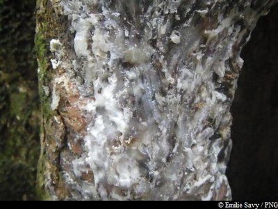
The Gommier (Dacryodes excelsa) can grow up to 35 metres tall. When they are damaged, its white trunk and roots exude a white resin with a pungent turpentine smell, which is traditionally used as incense or as kindle-wood, because it burns slowly regardless of the surrounding humidity. It is said that the tree has the ability to cast out spirits. It is strictly forbidden to take away any plant parts from the National Park. Its trunk was used by American Indians to make their canoes (kanawa), and is still used today by coastal people from many tropical countries, such as Dominique, to craft fishing vessels. The tree's seeds are a favoured food with pigeons.
Cascade sur Bras David - Emilie Savy / PNG  River and waterfall
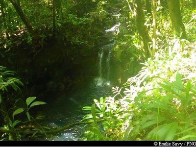
View of the waterfall
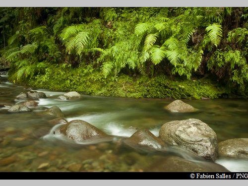
View of a small, freshwater waterfall on the Bras David river, below the trail.
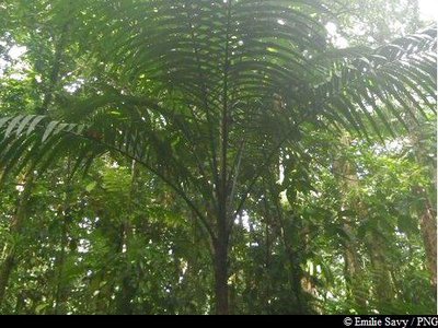
Palmier montagne - Emilie Savy / PNG  Flora
FloraThe Sierran palm
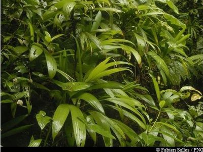
Prestaea montana is a member of the Arecaceae family. Despite its height, the Sierran palm is not a tree. Much like ferns, it does not have a trunk but a stipe. It can live in both hygrophilous forest, where it can reach a height of ten meters, and at altitude, where it does not grow beyond two metres.
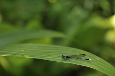
Argia concinna - F.Salles - PNG  Fauna
FaunaArgia concinna
Argia concinna, known commonly in French as "The Blue Damsel" for its beautiful colours, is endemic to the Lesser Antilles.
 Area of relaxation
A lagoon full of mullets
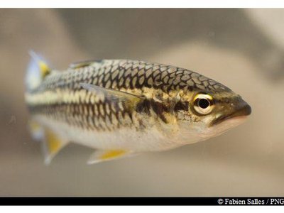
A perfect spot for a picnic. Here, you can see mullets. The mountain mullet (Agonostomus monticola) has a dark, greenish-brown back and a white front. Its fins are pigmented yellow. It is a carnivorous fish, hunting insects, shrimp but also fruit.
N.B. Fishing is prohibited at the National Park.
 Flora
FloraBwa rouj carapate
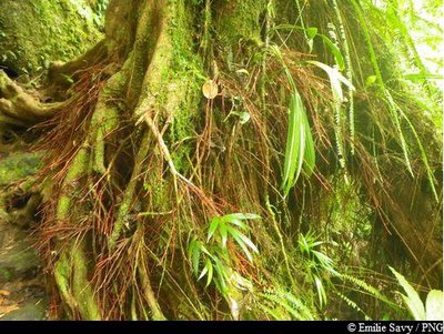
A member of the Euphorbiacieae family, Amanoa caribeae is endemic to the Lesser Antilles. It is a large tree with a trunk that rests straight on its buttresses, depending on the terrain. The most distinctive feature of this species is its reddish bark and roots at the foot of the trunk. Its leaves vary in shape: sometimes they are whole, sometimes pointed. Its flowers form small clusters, while its very hard wood was used as timber or in carpentry.
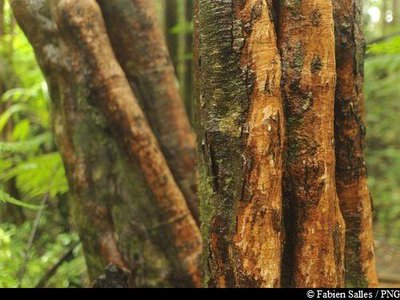
Bois cotellette noir - Fabien Salles / PNG  Flora
FloraTapura latifolia
Tapura lotifolia is a member of the Melastomaceae family. With a fluted trunk, this tree rarely grows taller than 20 metres. Its leaves feature five main veins that run perpendicular to its many secondary veins.
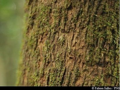
écorce de Bois Bandé - Fabien Salles / PNG  Flora
Flora"Bwa Bandé"
Richeria grandis, known in créole as "Bwa bandé", belongs to the Phyllanthaceae family. It is a large variety, distinctive for its tough leaves and reddish-brown bark that so often falls victim to rogue extraction. It is renowned for its aphrodisiac properties. Its wood is used as timber or in carpentry. It has very distinctive, green grape-like fruits which form small pods and appear copiously on its branches.
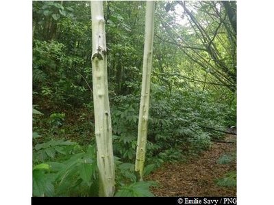
Bois cotellette blanc - Emilie Savy / PNG  Flora
FloraMiconia mirabilis
Miconia mirablis is a hardwood tree with white bark and fluted trunk. As is so distinctive of pioneer plants, it loves light. It is often found on paths alongside tree ferns or trumpet trees.
 Flora
FloraPumpwood
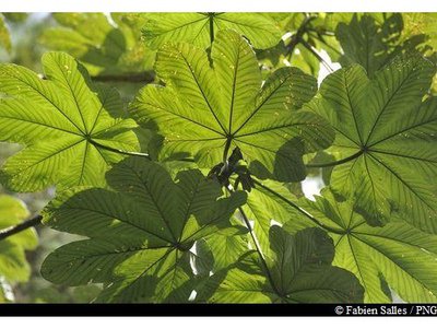
Most common in light, windfall area or at roadsides, the Pumpwood (Cecropia shreberiana) consists of a straight, hollow trunk with white bark and few branches. Here, you cannot miss it when you leave the forest and when you arrive at the intersection with the road. Its webbed leaves are white underneath and highly distinctive. They are green on top and form in clusters at the ends of branches. The Pumpwood flowers all year round. In traditional medicine, its leaves are made into a decoction which is used as a diuretic. It also acts as a tonic, anti-asthmatic and cardiac stimulant. Its latex can be used to treat bruises and surface wounds. The sap from its folded leaves is used to treat bronchitis.
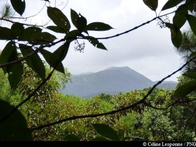
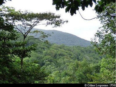
point de vue sur les Mamelles - Céline Lesponne / PNG  Viewpoint
Viewpoint
First viewpoint from the track running alongside Route RD23.

point de vue sur la Mamelle de Petit-Bourg - Céline Lesponne / PNG  Viewpoint
Viewpoint
Second viewpoint from the track running parallel to Route RD23: view to the west looking towards Mamelle de Petit-Bourg.

point de vue sur les Mamelles - Céline Lesponne / PNG  Viewpoint
Viewpoint
Third viewpoint from the track running parallel to Route RD23: view to the west looking towards Mamelle de Petit-Bourg.
 Viewpoint
Viewpoint
Fourth viewpoint from the track running parallel to Route RD23: view to the west towards Mamelle de Petit-Bourg and overlooking the east/south-east side of the ridges.
 Flora
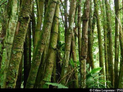
FloraBamboo
Bamboo is an invasive species in Guadeloupe, having colonised roadsides and riverbanks. Recommendations have been made for bamboo growth to be controlled, or even eradicated, in certain areas. It is very difficult to control this species, however, as doing so requires careful planning and the use of techniques that do not damage local species.
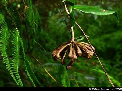
"Bois couille" - Céline Lesponne / PNG  Flora
Flora"Monkey paws"
Marcgravia umbellata is more commonly known as “Monkey paws”. This epiphytic plant clings to trees in order to access the light. Once it reaches the tree tops, the vine separates from the trunk. The stem then shoots a sort of flagellum downwards that takes root in the ground, before the cycle begins again.
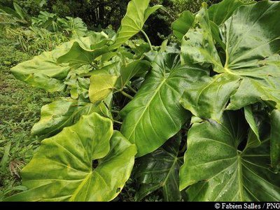
siguines blanches - Fabien Salles / PNG  Flora
FloraGiant Philodendron
The Giant Philodendron (Philodendron giganteum) is an epiphytic or terrestrial species that flourishes in humid or shady areas. It grows equally well from the earth as it does on rock or in trees. It develops copious long aerial routes which are used in basketry. It has large, dark green leaves that are fleshy and shiny to the eye. Each leaf is supported by a large petiole measuring between 0.6 and 1.5 metres, which grows from a large yet short stem resting on trunks or rocks.
 Viewpoint
Viewpoint
Viewpoint towards the north (Grosse Montagne), from the track running parallel to Route RD23.
 Flora
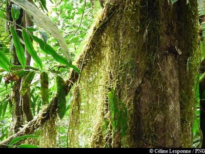
Flora"Cheveux d'ange"
These lichens are known as cheveux d'ange, which translates from French as "Angel's hair". They use other plants as support.
 Flora
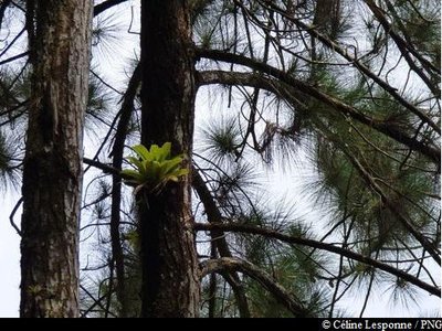
FloraCaribbean pine
The Caribbean pine (Pinus caribeae) is a member of the Pinaceae family. Now considered an invasive species in Guadeloupe, this tree was introduced so that its wood could be used as timber. It has noticeably cracked, reddish-brown bark. The inner bark is highly resinous. It has a slender top which is shaped like a rounded pyramid.
 Flora
FloraAmid the forkedferns ...
Dicranopteris pectinata is a member of the Gleicheniaceae family. It is a pioneer species that is so typical of open and sunny areas. It colonises landslide areas, the edges of forest roads, river banks and, generally, any surfaces that have been severely stripped back in wet areas. This fern's network of underground roots plays a key role in consolidating the topsoil.
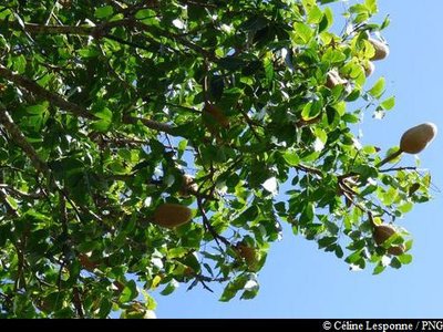
Mahogany Grandes Feuilles - Céline Lesponne / PNG  Flora
FloraWest Indian Mahogany
A member of the Meliaceae family, Swietennia macrophylla is a perennial tree with a straight, cylindrical bole. It has small, yellow-green flowers. This species was introduced in order to produce timber. Because of its hardness and colouration, the wood is highly prized by cabinet makers, which has resulted in it being over-exploited in its native area. It is listed in Appendix II of the threatened species covered by the Washington Convention.
 Flora
Flora"Ailes à mouche"
A member of the Cyclantaceae family, the local name for Asplundia rigida can be translated literally as "fly wings" on account of its similarity with the insect. A typical species of moist forest undergrowth, there are three species in the Asplundia genus. Two terrestrial and one epiphytic and lianescent (vines climbing from aerial routes).
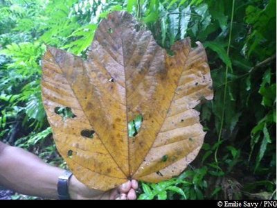
feuille de Mapou Baril - Emilie Savy / PNG  Flora
FloraMapou baril
Sterculia caribea, known in Créole as Mapou baril, is endemic to the Lesser Antilles. The leaves of this plant can differ depending on its age. Its flowers appear in the form of a bunch of small yellow and pink bells. It produces quite distinctive fruits that cluster together in groups of four or five in woody follicles: they are lined on the inside with dark red urticating bristles.
Description
Hiking trail colour: yellow
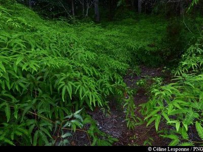
Leaving your car at the top, start from Maison de la Forêt, cross the road and take the path signposted as "Trace Rivière Quiock" (Quiock River Trail). The trail is often muddy, with slippery and surface roots. After a short walk, the Bras David river will come into view.
As you stay on the same path, the trail leaves the river bank of Bras David and heads up towards the plateau. At no point does the trail separate off clearly, but there are numerous river crossings. Each time you cross the river, make sure you return to the path (signposted in yellow) on the other side. At the last river crossing, follow the path and do not take the old staircase, which is in a state of disrepair. The path heads back up, with steps in the ground. When you get to a wider and grassy track (Point 1), turn left. After around 10 minutes, you come out onto Route RD23 (Point 2). Follow the road down for around 40 metres, and then take the new forest track that runs parallel to it on the left. Keep going on the track, following the yellow arrows that point the way to the exits on the roadside/entrance to the forest. Once you reach the opening onto the RD23 (Point 3), cross the road carefully. Then take the stream section opposite (Point 4) to return to Maison de la Forêt (Point 5).
- Departure : Maison de la Forêt, Petit-Bourg
- Arrival : Maison de la Forêt, Petit-Bourg
- Towns crossed : Petit-Bourg
Altimetric profile
Recommandations
Pay attention to cars on Route RD23, as it is a major road.
There are no litter bins on the route, so please be considerate and take your rubbish with you.
Extra care should be taken in this natural environment, as Guadeloupe is prone to natural risks. For the benefit of all hikers, it is very important that you behave responsibly.
Please note : the parking and swimming areas are not supervised.
Information desks
Maison de la Forêt
RD 23 - Route de la Traversée, 97170 Petit-Bourg
Opening hours :
- In low season (May 1 to June 30 and September 1 to October 31) : every day (except weekends) from 9 am to 4.30 pm.
- In high season (November 1 to April 30 and from July 1 to August 31) : every day from 9 am to 4.30 pm ; sunday from 9 am to 12.30 pm.
Services: reception, permanent exhibition, free parking, picnic area nearby. Building accessible to people with reduced mobility.
Please note : parkings are not supervised.
Localisation GPS : Lat: 16,17600 N - Lng: 61,69280 W.
Access and parking
GPS coordinates of the start point : Lat : 16,17600 N - Long : 61,69280 W.
From Bouillante or Petit-Bourg : take Route de la Traversée (RD
23). Leave your car in one of the parking areas at Maison de la Forêt.
Parking :
Source
Report a problem or an error
If you have found an error on this page or if you have noticed any problems during your hike, please report them to us here:

