Great North trail
La Desirade Coastal trail
Great North trail
Medium
2h
1,9km
+151m
-158m
Loop
PR (short hike network)
Embed this item to access it offline
6 points of interest
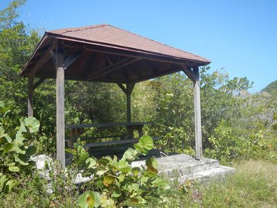
Carbet - F.Frederic - CD 971  Area of relaxation
Carbet
When coming out of the undergrowth, on the left, a carbet can offer a relaxing break.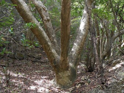
Mapou gris - F.Frederic - CD 971  Flora
FloraMapou (birdcatcher tree)
Large specimen of Grey Mapou, Pisonia subcordata, characteristic of plants adapting to dry conditions.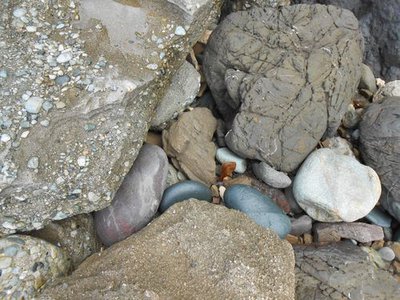
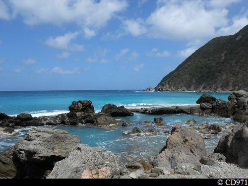
Roches - F.Frederic - CD 971  Geology
Rocks
A rainbow of colours is made by the rocks.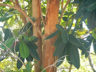
Bois d'Inde - F.Frederic - CD 971 FloraBay rum tree
Bay rum tree (aromatic plant), Pimenta racemosa.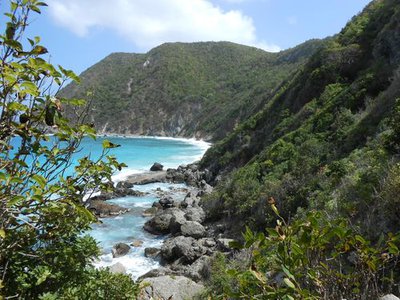
Falaise - F.Frederic - CD 971  Viewpoint
Cliff
Sweeping view of the cliff and the sea.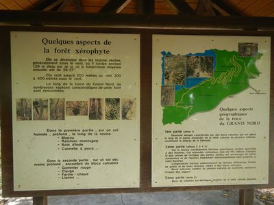
Panneaux d'information - F.Frederic - CD 971  Information board
Information
Information panels explaining local history and geography on the Great North trail.
Description
Go into the undergrowth and begin the descent through the dry rainforest, following the yellow waymarkers to reach the coast.
Climb down to the rocky beach and walk along the coastline through the rocks for approximately 300 m (see the range of colours in the rock formations). Climb back up in the undergrowth on the left, up to reach a tufa (limestone) track. Turn left, passing the carbet, to reach the Chemin de Croix; then continue to the left to return to the starting point.
Climb down to the rocky beach and walk along the coastline through the rocks for approximately 300 m (see the range of colours in the rock formations). Climb back up in the undergrowth on the left, up to reach a tufa (limestone) track. Turn left, passing the carbet, to reach the Chemin de Croix; then continue to the left to return to the starting point.
- Departure : 100 m below the parking area, turn right into the undergrowth.
- Arrival : point of departure.
- Towns crossed : La Desirade
Altimetric profile
Recommandations
Be careful: steep descent
Do not take this trail if the sea is rough.
Do not take this trail if the sea is rough.
Information desks

"Beausejour", capitainerie, 97127 Désirade
Access and parking
Starting point : Lat : 16,312417 N - Long : 61,074587 W.
---
From Beauséjour, climb towards the chapel (Chemin de Croix).
---
From Beauséjour, climb towards the chapel (Chemin de Croix).
Parking :
Small area of landscaped parking, 100 m above the trail departure point, in the bend of the road which leads to the chapel.
Source
Rando Guadeloupehttps://www.randoguadeloupe.gp/
Report a problem or an error
If you have found an error on this page or if you have noticed any problems during your hike, please report them to us here: